
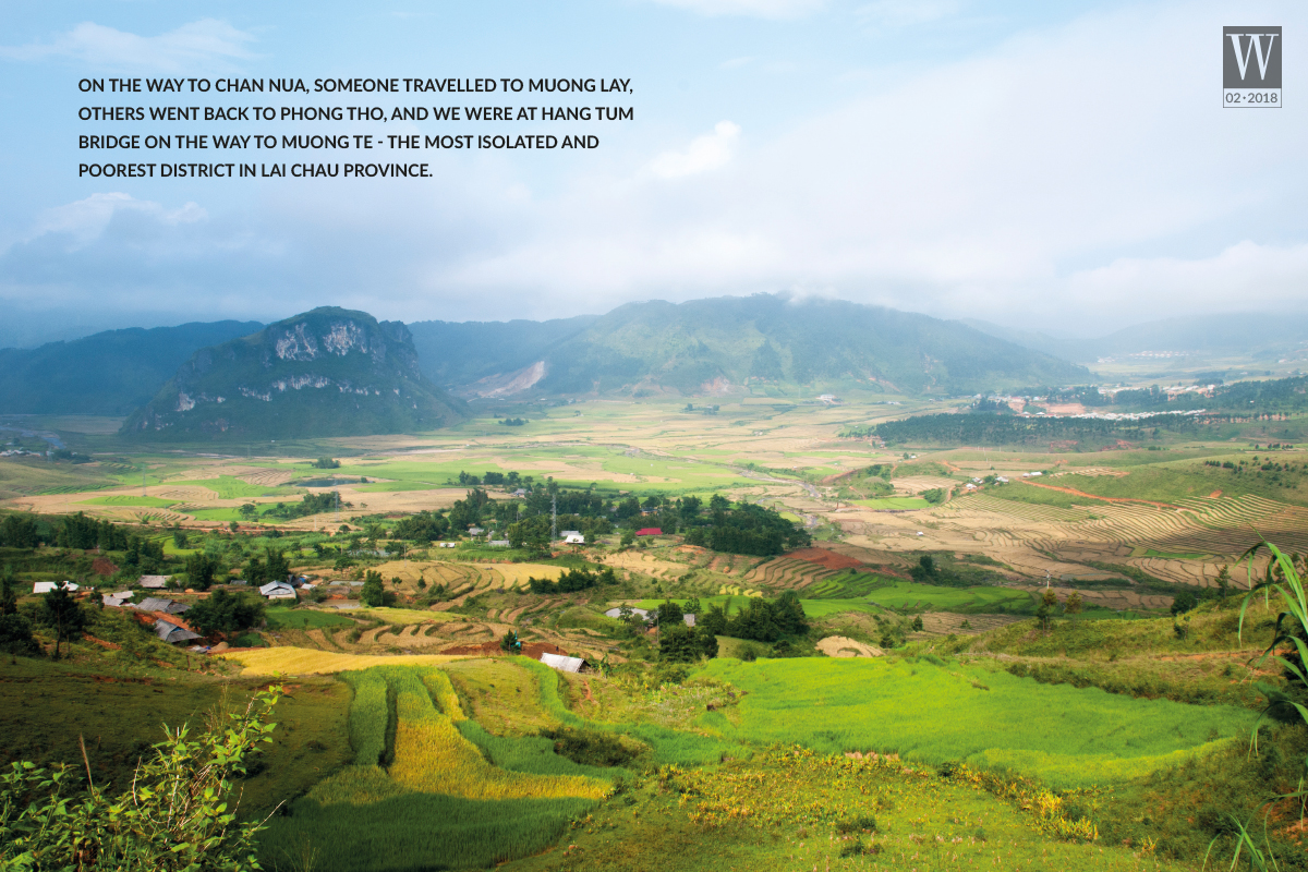
On the way to Chan Nua, some travelled to Muong Lay, others went back to Phong Tho, and we were at Hang Tum Bridge on the way to Muong Te – the most isolated and poorest district in Lai Chau province.
[rpi]
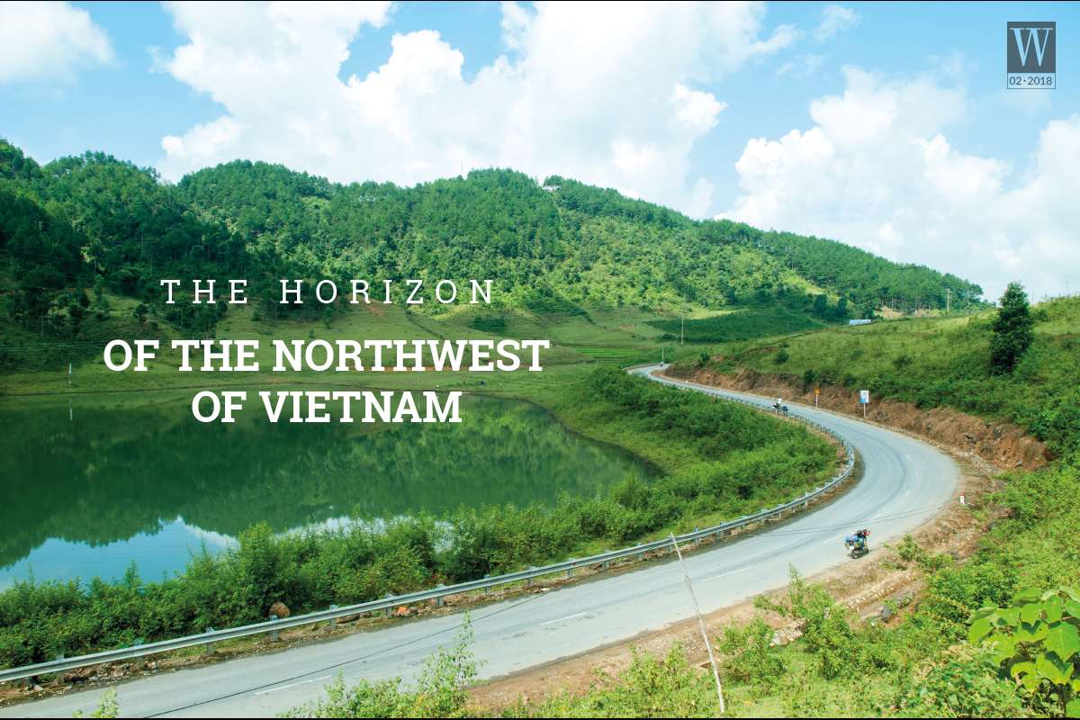
People who have visited Lai Chau in the past (including Dien Bien province) and at present certainly cannot forget the land at the end of Northwest Vietnam where there are many people and unknown places at the border area. Those who have visited Than Uyen in the autumn, struggled to cross O Quy Ho, climbed Phong Tho slope to Muong Te, Ka Lang and Thu Liem, and those who have travelled to Sin Ho, Muong Lay to swim in the Da river will understand the passionate feelings brought by this land. Though Lai Chau is not as famous as Sapa, Moc Chau, and Ha Giang that welcome thousands of visitors every year, it owns the hidden beauty of the mountainous regions at the border area, which is home to towering mountain ranges and dances of the Hmong, the Mang, and Si La people.
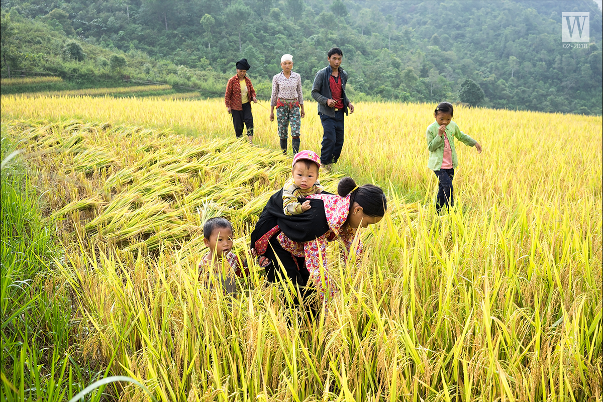
We turned our backs on the crowds entering the city, away from the noise and bustle of the city and followed the National Highway 32 to Thanh Son, Thu Cuc and Tu Le, visited Mu Cang Chai in the autumn where the golden colour of rice spread on the hillside, bringing fullness to ethnic people’s lives. Though having no hillside filled with rice, Muong Than is considered as one of the four largest paddy fields in the Northwest of Vietnam, as in the phrase: “ Thanh ranked first, followed by Lo in second place, Than in third place, and Tac in fourth”.
This place attracts travellers with its abundance of wind and sunshine. Those who have travelled to Muong Thanh in the fall would understand what I’m referring to. The sunlight was not too intense but mild, having a honey golden colour. Standing beside a small lake by the road at the border between Than Uyen and Tan Uyen, you will feel how the mountainous autumn is.
Though the lake was not too big, it was enough for the tourists to feel the cool atmosphere. Peaceful scenery appeared in every tree branch and grass. In the middle of the lake, there were several groups of small children riding buffalo and playing amidst the clear water. On the other side of the lake, there was a hill full of grass and an idle buffalo herd. The scenery that seemed to only be seen in the prairies of foreign countries was appearing in front of us. Everyone was surprised and speechless, only watching and saying: “How peaceful it is!”.
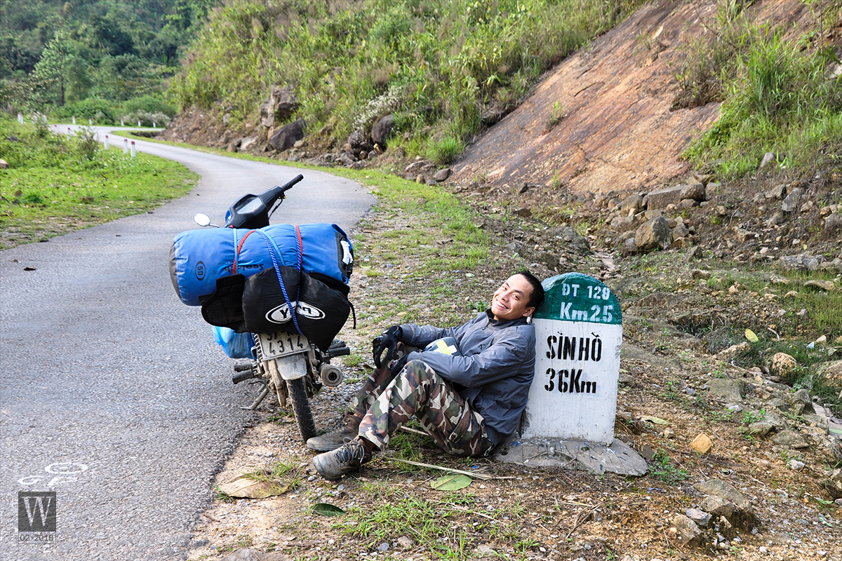
We drove and continued to feel the sunshine of Lai Chau and Tan Uyen with sweet tea hills, then arrived at Binh Lu. From there, if turning right, you will meet the sloping mountain pass O Quy Ho with a height of over 2,000 metres, stretching more than 40 kilometres to Sapa. If turning left, you will come to Tam Duong and the centre of Lai Chau province. Sin Ho welcomes visitors with its fresh thin fog, dimming houses of ethnic people, Lang Mo pass, Phang Xo Lin pass gradually full of wheel traces.
Do you know the origin of the roof tiles on Hanoi Opera House? They are from Hong Thu clay mines of Sin Ho district. On the way to Chan Nua, some travelled to Muong Lay, others went back to Phong Tho, and we were at Hang Tum bridge on the way to Muong Te – the most isolated and poorest district in Lai Chau province. Although the road to the district centre along Da river was rough, the peacefulness of the mountain and river landscape could be seen in every house of Ethnic Thai people. We went along the stream to find the upstream. Pac Ma is the crossroad to travel to Keng Mo or Ka Lang and Thu Lum. Keng Mo features border milestone No. 17 – marking the first point of Da River on Vietnam’s territory. From there, water flows through limestone cliffs, then flows into the Red River (Asia) in Phu Tho. Red River (Asia) has the total length of more than 500 kilometres, carrying alluvium that creates living sources for people along the upstream of the river. Thu Lum is at the end of Muong Te with a sacred stone of the Hani people. The white natural quartz on a small mountain is considered a sacred stone by Hani people and is worshiped every year. It is really special that the stone is also a natural border between Vietnam and China.
From here, if you want to go along the border, you can try the border patrol route to A Pa Chai or pass through the Pac Ma bridge to Mu Ca, Chung Chai, Sin Thau to conquer the border milestone No.0 – the shared border and crossroad of three countries Vietnam – Laos – China, which is located at the top of Khoang La San in Dien Bien province. And if you are interested in exploring caves and waterfalls, there are many attractions such as Pu Sam Cap cave, Ta Tinh waterfall, Vang Bo hot spring and Tien Son cave.Lai Chau is located at the furthest and most isolated place in the country.
Those who have travelled to this land may never forget the bright sunshine and the wind of Than Uyen, the chill of Lang Mo, the rapids at Da river’s upstream, passionate cups of wine of the H’mong in Thu Lum, or the precious kindness of the border police at Keng Mo station guarding the border of the country. From the plains, we travelled through the midland, along Da river, sought its upstream and came back to the city with nostalgia for the land at the end of Northwest Vietnam.
W.TIPS
TIME. The best time to visit Lai Chau is usually in the spring or autumn, as the summer is quite hot and the winter is cold. You will see many plum and apricot blossoms throughout the village in the spring. If you are lucky, you will have the opportunity to admire a sea of clouds in Sin Ho. Many festivals of ethnic groups are usually held in the spring. In the autumn, you can explore the upstream of Da River or visit the caves and waterfalls. Autumn is also the season of golden terraced fields. And do not miss the colorful markets of ethnic minorities.
TRANSPORTATION
To explore Lai Chau, you can travel by motorcycles, buses, and cars. Lai Chau city is 400 kilometres away from Hanoi if you travel on Lao Cai expressway and more than 450 kilometres if travelling on the National Highway 32.
If travelling by coaches, you can go to My Dinh bus station (Hanoi) to go to Lai Chau; there are many different buses for you to choose daily. Or you can save time by travelling at night to Lai Chau or Muong Lay. Otherwise, you can take trains (or buses) to Lao Cai city, and then take buses to Lai Chau city. From the city of Lai Chau, you can rent a motorbike or take a bus to the district center to explore different attractions.
If travelling by cars, the shortest route is Noi Bai – Lao Cai expressway, through Sapa, Tam Duong, and Lai Chau city. you can visit many other attractions, then travel to Dien Bien, through Son La, Moc Chau, and Hoa Binh. You can follow National Highway 32 through Mu Cang Chai, Than Uyen, Binh Lu and Lai Chau; this is a beautiful route that is more scenic than the expressway.
Many young people choose a motorbike to explore the North West of Vietnam because they can drive further into the villages. Normally, you can drive along National Highway 32 through Than Uyen to Lai Chau, Sin Ho, Muong Lay, Muong Te and Dien Bien.
ACCOMMODATION. The centre of Lai Chau City is quite developed and newly planned with the migration from the old town of Muong Lay to the new city which is very spacious, clean and beautiful. There are dozens of small and big hotels in Lai Chau at affordable prices for you to choose from. District centers also have motels and hotels. If you travel further into villages such as Thu Liem, Ka Lang, Kogang Mo or Ma Lu Thang, you can sleep at the border posts or houses of ethnic people.
CUISINE. Lai Chau cuisine bears the common features of Northwest Vietnam which shares particular specialties of each ethnic group. The purple sticky rice or five coloured sticky rice is made from glutinous rice grown in the highland. Gobies grilled in the wood stove (Vang Phong, Phong Tho, Lai Chau) is a special dish of Tai Dón people. Pa Pinh Top is a grilled fish marinated with a variety of spices. Visitors can also try ban flower salad, vegetable fern salad, black pig, and smoked meat. Another interesting dish in Lai Chau is the rock moss, which is taken from the rocks in the streams, washed and processed into different dishes such as soup and grilled moss. It tastes like seaweed and is quite delicious. The blood soup with bitter leaves, Sung Phai corn wine, black sticky rice cake, round glutinous rice cake, and banh mat (molasses-sweetened glutinous rice cake) are also special features of the ethnic minorities in Lai Chau.
SUGGESTED ROUTES
The itinerary to explore Lai Chau from Hanoi will last from 3 to 7 days, depending on the type of vehicles and location. We suggest some routes for motorbikes/cars from Hanoi to Lai Chau and almost all major landmarks in Northwest Vietnam, as well as conquering the boundary milestone No.0 at A Pa Chai – Dien Bien. Depending on the time and means of transportation, you can shorten the route accordingly.
Day 1: Hanoi – Thanh Son – Thu Cuc – Tu Le – Mu Cang Chai
Day 2: Mu Cang Chai – Than Uyen – Tam Duong – Lai Chau city
Day 3: Lai Chau – Sin Ho – Phang Xo Lin – Chan Nua – Muong Lay
Day 4: Muong Lay – Muong Te – Pac Ma – Keng Mo – Milestone No.17 of Da river upstream – Ka Lang – Thu Lum.
Day 5: Thu Lum – Pac Ma – Mu Ca – Chung Chai – A Pa Chai
Day 6: In the morning, climbing the boundary milestone No.0 – a common point of Vietnam, Laos, China. In the afternoon, driving to Muong Nhe or Muong Cha.
Day 7: Muong Cha – Dien Bien – Son La – Moc Chau.
Day 8: Wandering in Moc Chau and returning to Hanoi.
Tran Giap | Wanderlust Tips