
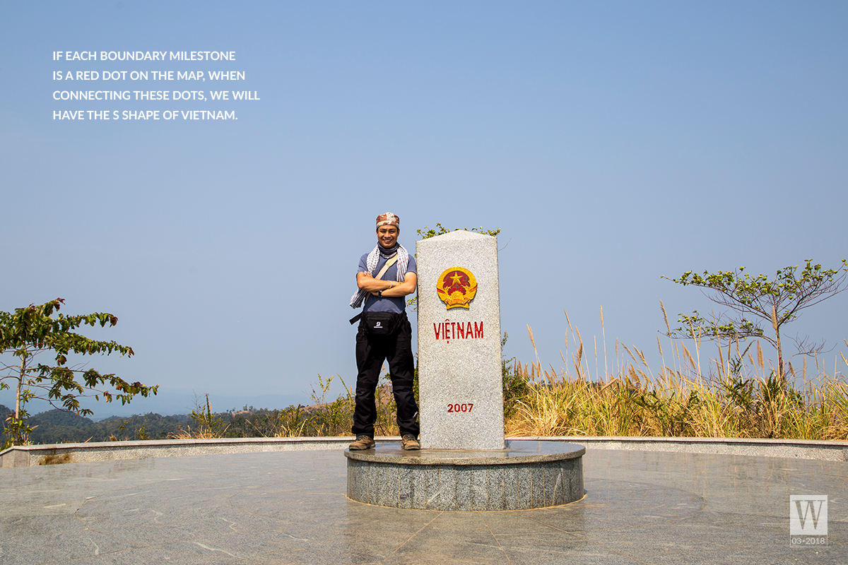
[Wanderlust Tips March 2018] If each boundary milestone is a red dot on the map, when connecting these dots, we will have the S shape of Vietnam.
[rpi]
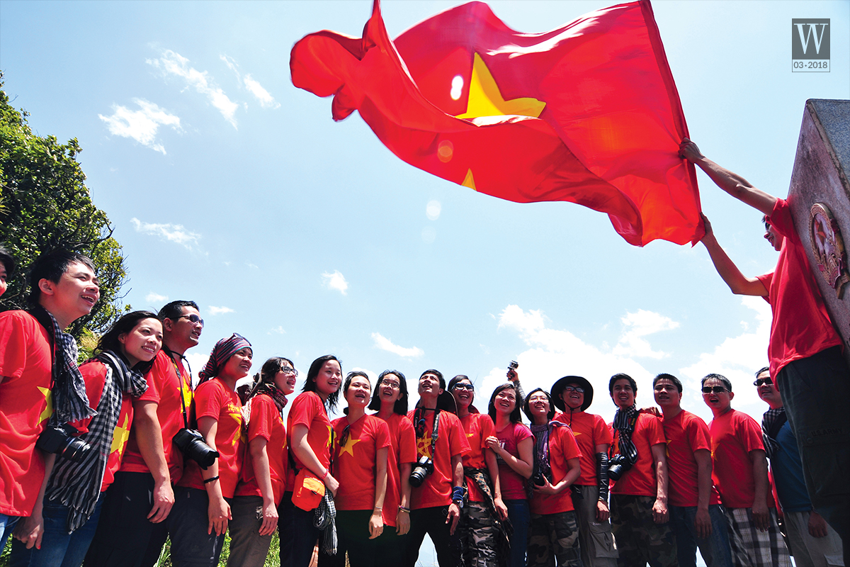
The painful but heroic historical fluctuations have passed to give Vietnam a peaceful and elegant S shape as it is today. Many predecessors have sacrificed their lives to keep every inch of the country’s border areas. The sacred land has been protected for thousands of years and it is definitely impregnable. Though in the past the boundary line of our country was not clear, at present, boundary milestones were located along the border, stretching tens of thousands of kilometers from Mong Cai (Quang Ninh) to Ha Tien (Kien Giang), which firmly claims the national sovereignty. Perhaps no one has ever travelled along thousands of boundary milestones on the borderline adjacent to China, Laos, Cambodia because they are extremely dangerous and challenging.
One of my most unforgettable memories is about the April days which are hotter than flames at the country’s westernmost land. The boundary milestone No.0 is located on the top of 2,000-metre high Shiceng Dashan, marking the tri-junction point of the three countries Vietnam – China – Laos. From here, you can look over Vietnam’s territory to be proud of a turbulent history.
On that day, in order to conquer the boundary milestone No. 0 – A Pa Chai, after having struggled to obtain a license from the Boundary headquarter of Dien Bien Province, I had to climb more than 12 kilometres through the forest as well as cross an “incredible” path from Muong Cha to the guard station No. 317 – where the journey began. After travelling more than 12 kilometres under the intense sun and the Foehn wind, then crossing 3 hills of cogon grass, my hands and legs were covered in bruises.
In some sections, we had to crawl or swing on a rope to cross the cliffs. Once you cross 3 hills of cogon grass, you will have to continue walking through a primeval forest, but it would be much better as there are streams of water and trees for shade. However, to reach the boundary milestone, you will have to swing on a rope again at the end of the journey. Although it was so hard, when standing on the top of the mountain, hugging the three-faced boundary stone and singing the song of youth, I felt so relieved.
There was only sun, a wind blowing, blue sky and us at the place where “when a cock crows, three countries hear”. This is the sacred westernmost point of Vietnam.
From the boundary milestone No. 0, if you go along the border between Vietnam and China, you will see more than one thousand boundary milestones with numbers arranged in ascending order. And at the end of that border, there is the last boundary milestone No. 1378 of the two countries, which is located at an extremely special position. This border milestone is located at the estuary of the Bac Luan River, in the small archipelago of Tra Co Ward, Mong Cai, Quang Ninh. It was built with a proper height so it would not sink at high tide, and of course, you will have to sail to conquer this interesting border milestone.
From the top of Shiceng Dashan, if you go along the Southern border of the country, you will meet the boundary milestones of Laos and Vietnam, then end up at another special point which is the Indochine boundary marker. This is the boundary milestone at the beginning of three Indochinese countries’ borders: Vietnam – Laos – Cambodia.
After travelling through dusty roads of the sunny and windy Central Highlands, the fragrant coffee fields in the middle of the flower season and enjoying stem wine at night, we went on the journey to conquer this interesting three-faced boundary marker. The road to Bo Y border checkpoint has been expanded and paved so it was not as hard to conquer as A Pa Chai boundary milestone. You can easily come here to enjoy the mountain breeze.
Indochina boundary milestone was also made of granite, in cylindrical triangular shape. It bears the national emblems of three countries on each side. The boundary milestone Iies in a grassy hill which is more than 1,000 meters high, surrounded by the mountains and forests but not as dense as those surrounding the West. From here, if you go to the south you will also encounter many boundary markers of Cambodia and Vietnam, in which the boundary milestone No. 240 is a very special one.
The boundary milestone No. 240 marks the first point where the Mekong River flows into Vietnam to deposit rich layers of alluvial sediment for the entire Mekong Delta over the years. This boundary milestone is at Thuong Phuoc border checkpoint of Dong Thap province. While Southern Vietnam has the Mekong river, the Northern has the Red River (Asia), and interestingly, at the crossroad of three countries, there is also a boundary milestone No. 92 marking the first point where the “Red River flows into Vietnam”. It is located by the river where the Red River from Chinese territory meets Lung Po stream to create a river full of red alluvium for the Northern Delta. And if you go along Da River, you will meet the boundary milestone No. 17 which marks the first point of Da River in Vietnam, in Keong Mo, Muong Te, Lai Chau.
People may have to spend all of their lives to go through thousands of border stones which mark the country’s sacred sovereignty. Some boundary milestones are located right next to the national highway, but others are in the dense forests, so it is not easy for people to conquer all of them. The boundary milestones No. 79 and No. 42 are two such unique ones. The boundary milestone No. 79 is considered as the highest in Vietnam, located on the top of Phan Lien San Mountain at an altitude of nearly 3,000 metres, which is known as the most dangerous location of the Vietnam-China border. The boundary milestone No. 42 is located at a height of over 2.800 metre in Pa U commune (Lai Chau), which is also a great challenge for anyone who wants to conquer it.
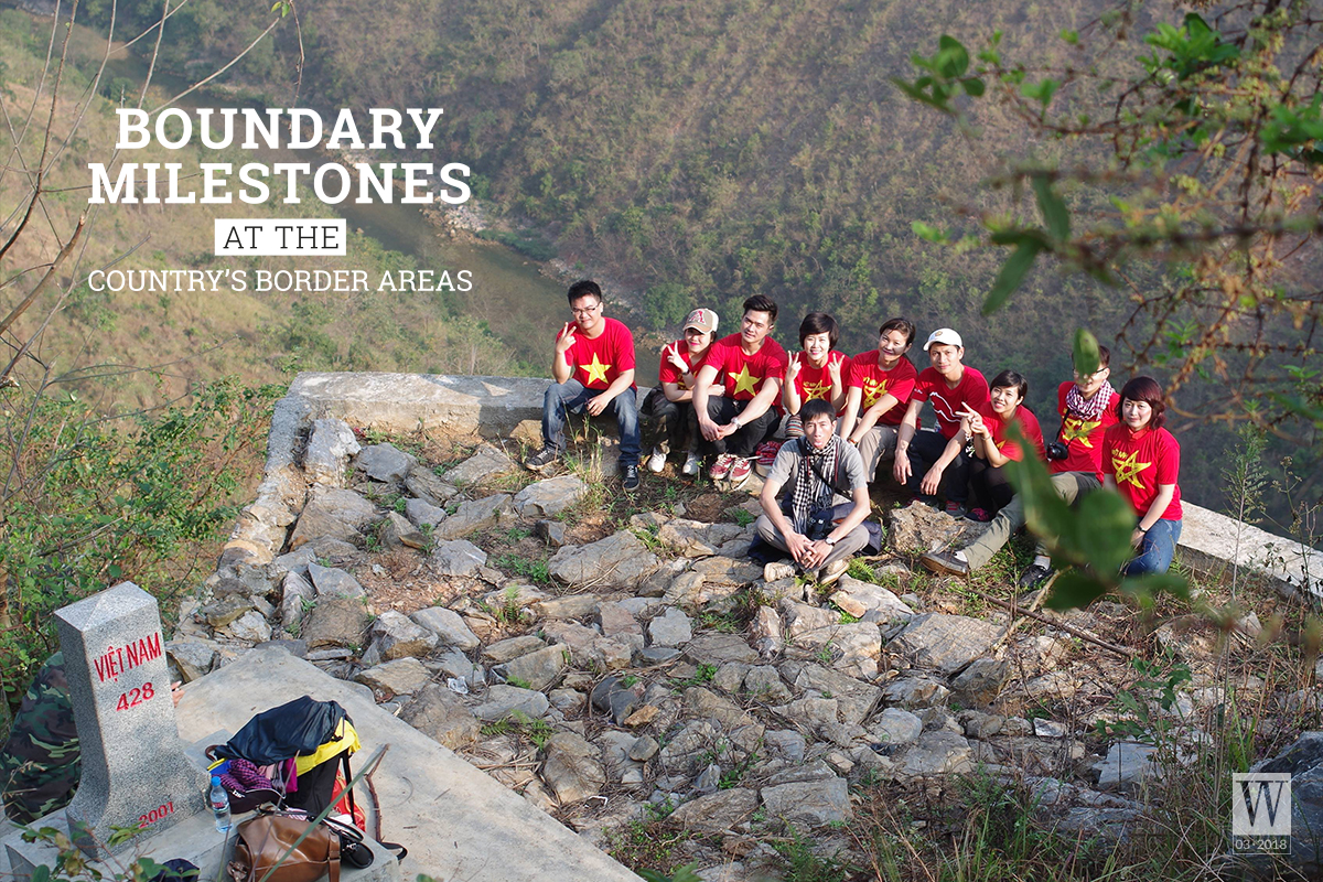
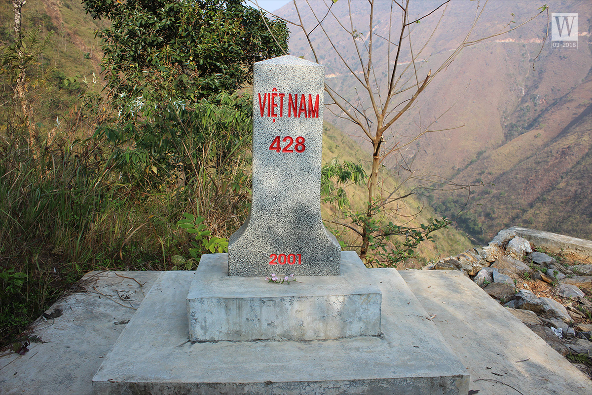
If the boundary milestone No. 0 – A Pa Chai marks the Westernmost point of Vietnam, the border milestone No. 428 is considered the real northernmost point (the symbolic one is the Lung Cu flag tower). Travelling from the end of Xeo Lung village, you have to walk 3 kilometres across the rocky mountain, through border milestones No. 426 and No. 427 to reach the border milestone No. 428. This is the first point of the Nho Que River flowing into the territory of Vietnam.
Also, do not miss the boundary milestone No. 314 in Ha Tien town, Kien Giang because it is the last on-land boundary marker of Vietnam and Cambodia. The afternoon sunlight at the border spreads a golden layer like honey on the roads, fields, buffalo herbs lying on the field, making anyone visiting here feel so touched. The scenery was so peaceful though the land at the end of Vietnam’s on-land territory had gone through a woeful and majestic history.
It is so hard and challenging to travel through even only some boundary milestones, some amidst the river, some on high mountains covered by clouds all year round. Do you dare to conquer? If so, prepare to go and admire how beautiful Vietnam is.
Tran Giap | Wanderlust Tips